Directions to Fort Collins
From Denver International Airport
- When leaving the airport, take Peña Blvd to E-470 N and I-25 N to CO-14 W/E Mulberry St in Larimer County. Take exit 269B from I-25 N.
- Follow E Mulberry St to S Sherwood St in Fort Collins – 10 mi.
From Cheyenne, Wyoming
- Get on I-25 S/US-87 S – 1.7 mi.
- Follow I-25 S/US-87 S to CO-14 W/E Mulberry St in Larimer County. Take exit 269B from I-25 S/US-87 S – 32 mi.
- Follow E Mulberry St to S Sherwood St in Fort Collins – 10 mi.
From Rocky Mountain National Park
- Follow US-36 W and US-34 E to N Wilson Ave in Loveland – 37.5 mi.
- Continue on N Wilson Ave. Take Taft Hill Rd to S Sherwood St in Fort Collins – 23 mi.
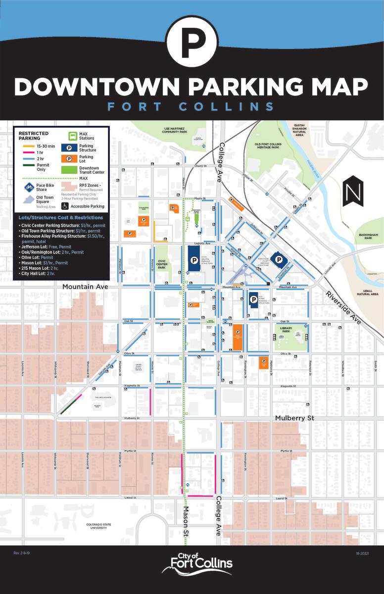
Parking Downtown information:
Downtown offers a variety of parking options, including on-street, parking structures, and surface lots. In general, the on-street parking in the core of downtown has 2-hour time limits, while the parking around the periphery of downtown has free, open, all-day parking. On the map below, the 2-hour parking is shown in the light blue.